Trulia adds commute maps
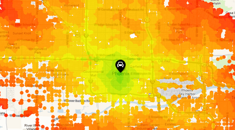
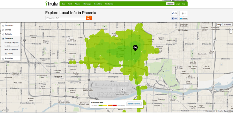
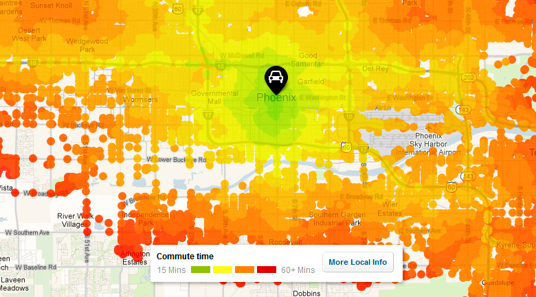
For years, we at AG have advocated for better data visualization, but more importantly, we have long advocated for more useful information in visualizations. Real estate search company, Trulia, has just launched commute maps in beta to show how far one can drive from any given point in a select number of minutes.
A commute is put in context, so that travel time to work or any regular location is well understood, which is critical given that the age old mantra of real estate is “location, location, location.” Now, that location makes sense on a map for anyone considering moving to a new neighborhood. The heat map shows commute times as a user slides the time allotment up or down.
Currently, the heat maps show commute times for driving and public transit, joining the lineup of information layered onto Trulia’s local maps (currently including crime, schools, and amenities like grocery stores and restaurants).
The company says they are launching driving times in every city, but are limited to public transit data available from government data. Additionally, the driving data is derived from Open Street Maps and the public transit data is from local government transit agencies.
“From a technical standpoint, nobody has been able to build what we are unveiling today. Our geo-engineering team has been focused on creating a one of a kind experience that is easy to use and super helpful for homebuyers and renters,” said Ken Shuman, company spokesperson.
“Consumers tell us time and time again that the visual tools we create is one of the things that sets us apart from the competitors. As a company we will continue to invest in these solutions and continue to deliver the best tools for consumers and the industry,” said Lee Clancy, VP of Consumer Products.
The American Genius is news, insights, tools, and inspiration for business owners and professionals. AG condenses information on technology, business, social media, startups, economics and more, so you don’t have to.


